
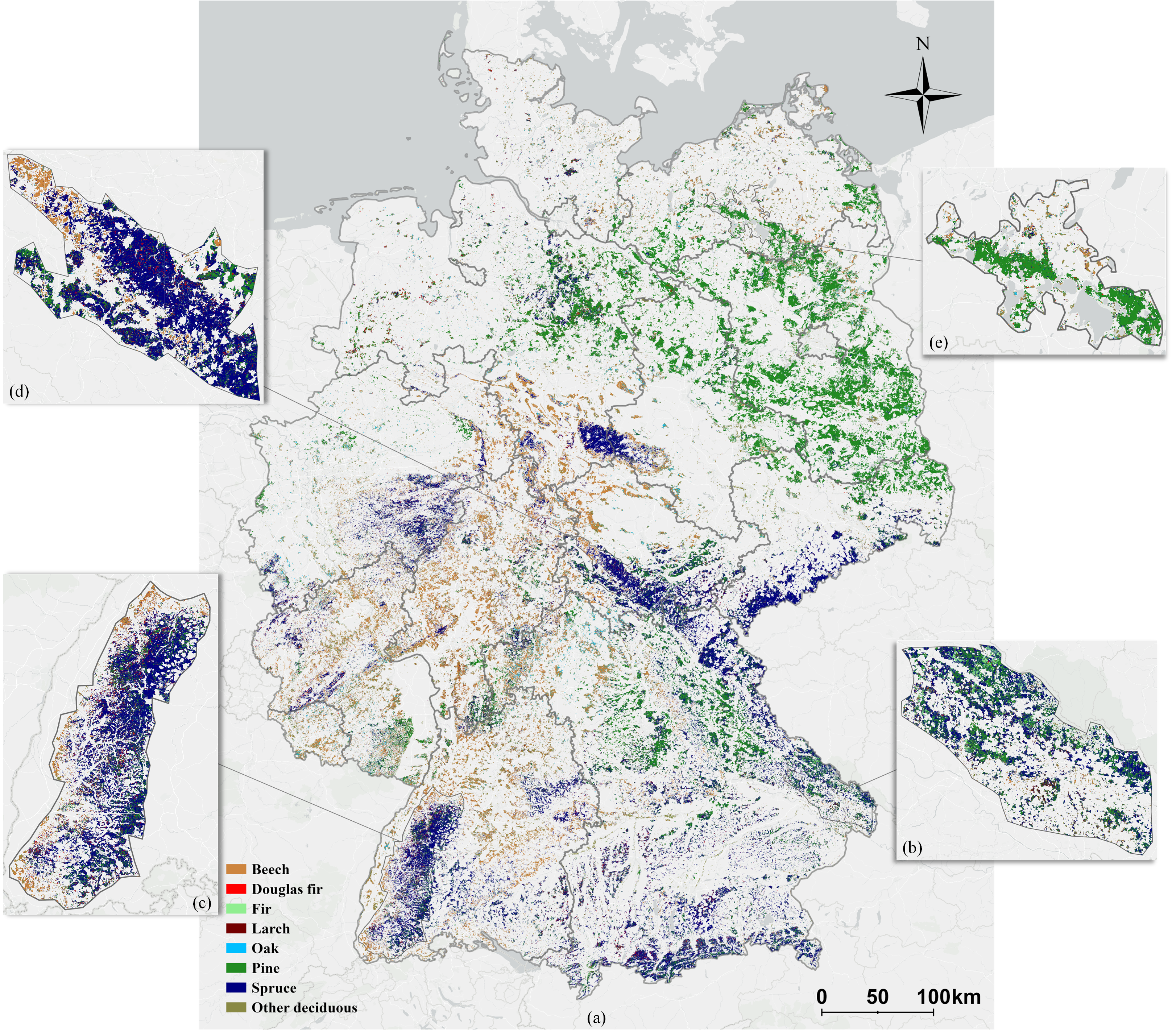
The Federal Republic of Germany has a total of 11.4 million hectares of forest and a substantial forest stock volume of 3.7 × 10⁹ cubic meters. Fig.1 shows the specific location.
There are five main stages: satellite data acquisition, label generation, training data preparation, model training and mapping.
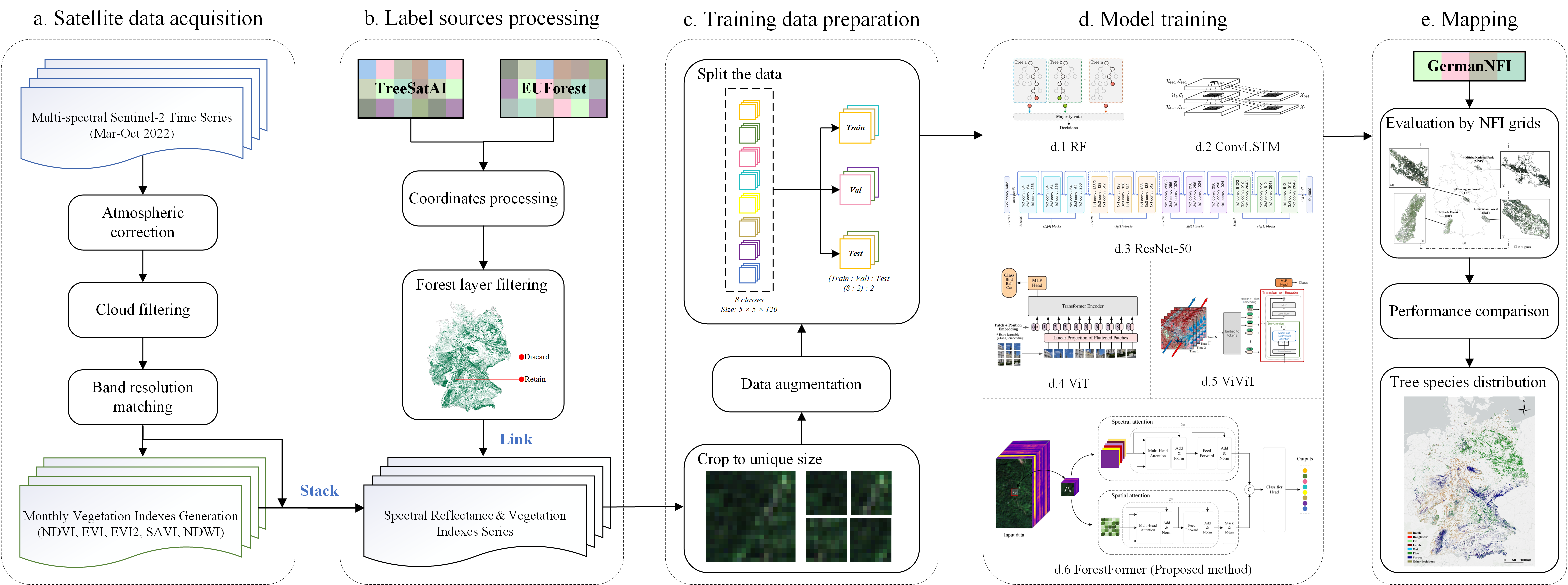
The proposed ForestFormer integrates a dual-branch network architecture, complemented by attention mechanisms from the Transformer model in both spectral and spatial domains.

The pytorch code of this work is available from Pytorch_Tree-Species-Mapping.
Tree Species Distribution map of Germany.
The data for model training are available to the community (Training data). The correspondence between labels and tree species is: {'Beech': 0, 'Douglas fir': 1, 'Fir': 2, 'Larch': 3, 'Oak': 4, 'Other deciduous': 5, 'Pine': 6, 'Spruce': 7}.
The tree species distribution products covering Germany are available to the community (Dataset). This dataset includes 16 states of Germany.
E-mail: yang.mu@tum.de